Rain, snow, thunder/lightning, heat...it can all happen on any given day. The question is, did I bring the gear to get through it. On most hikes, you can ask me to show you my 10 ESSENTIALS. It's rare that I would hit the trail without them. They are a baseline for any daypack, and they can be carried in many different shapes and size

Since most of my excursions are going to 14,000 foot peaks, I'm spending a considerable amount of time gathering beta from 14ers.com. I can pull route descriptions (including photos and maps), read trip reports, find out about current conditions, and get localized weather predictions from NOAA. It is also a great resource to provide for my check-in person.
I can send them a link to my specific route, and if anything happens they have access to the right sheriff's department and readily available materials to provide them for locating me. Now, I don't just leave my check-in person sitting around waiting in wonder. My usual routine is as follows:
- Send Link to full Route Description (if there is no link, provide very specific trailhead, and route plans)
- Include a complete gear list
- Include the local Sheriff's Phone Number
- List an expected start time
- List an expected finish time
- Provide a specific time to call the sheriff's office if I have not checked-in (I usually allow for a 4-6 hour buffer)
If I'm in the mountains solo, I also leave the above information on the dash of my car. I guess it is important to note along with the route details on my dash, I leave a note for my loved ones. Now, as you know I proceed into the mountains with the intent of making decisions that will return me to my car at the end of the day. In the event that this may not happen some day, I want a proper goodbye available to my family.
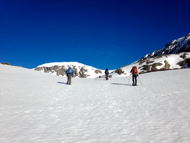
 OFF THE MOUNTAIN BY NOON. This is my go to for route planning. I don't mind Mother Nature doing her thing, but I don't want to be the tallest object above treeline when the storm clouds come in view. You may have bluebird skies at 6:00am, but as the day progresses, the clouds pop up. Slowly at first, then they multiply like lilies in a pond. Before long, they unite as one big storm cloud. Personally, I like to be in my car or tent by the time this happens - occurring most frequently from 12:00-2:00pm daily.
H2O AND GO. Even before I think about carbs, sugars, and proteins, I'm thinking about water. How much do I bring? No less than 2 liters, usually 3. What happens if I run out? Is there a water source? Do I have a filter or do I use iodine tablets? The upside of a filter is having immediate drinking water. Iodine tablets or other chemical treatments can need 20-30 minutes.
Hydrate before, during, and after - the elevation can really take it out of you.
Hydrate before, during, and after - the elevation can really take it out of you.
 MMMM...FOOD. Like water, food is another item I don't scrimp on for summit pushes. My go to items are beef jerky, rice mix, animal cookies, dried fruit, pizza (yes, pizza), and my absolutely fave summit snack is hummus. There's nothing like a savory, delicious, meal after gaining 3-4,000 feet in the mountains. I generally bring at least twice as much food than I need. Better safe than sorry, right?
After finishing a hike, I generally pack in a good amount of protein and sugars to replenish and rebuilt what I've used up on the trail. I find that bacon cheeseburgers are an ideal option - sometimes I even forget to breath while inhaling them.
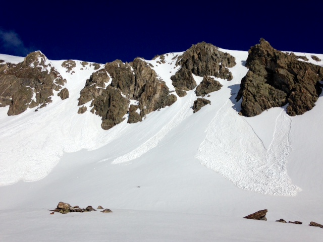
SAY NO TO COTTON, AND STAY DRY. Granted I did intentionally break this rule in March on Beirstadt. The sun was beaming down, and then back up from the snow. I needed to cool off, so I dumped snow down the back of my shirt on the descent. In general, you should go to great lengths to stay dry. This includes slowing your pace or taking breaks to prevent from sweating. Carrying extra layers (part of the 10Es), is always a good idea.
Moderate hypothermia is manageable, but it can turn into severe hypothermia very fast. If you are ever out in the backcountry with some one experiencing hypothermia, get them in dry clothes, and get them insulated as soon as possible. If you have a stove, heat water for bottles, and put the bottles in high pulse areas: the armpits, the torso, the groin.
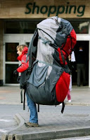 MY CLOSETS ARE OVERFLOWING WITH GEAR. This is where things get crazy. The good news about car camping, everything goes. If your hiking into to camp, it gets a little more challenging. What do you absolutely need? What is a nice addition? What is a luxury? After waying your options, hopefully you're down to around 30lbs for a multi-day trip, maybe less.
I'll be climbing Class 3 and above, so the helmet comes along. The late snow could present unexpected surprises, even in July, so the ice axe and crampons come along. The snow probably isn't that bad, so the lighter crampons come along with the lighter boots, instead of the heavy mountaineering boots. Oh, don't forget to rec-oat them with water proofing for the season.
The decisions will go on and on until gear is sorted into the "go stack" and the rest heads back to storage.
THE SPOT. "A day of worry is more exhausting than a week of work." ~John Lubbock. Let's be honest, parents tend to worry, sometimes to the extremes. Just ask me to tell you the Boliver ferry story someday. The reality is, things do happen. So, why worry them anymore than necessary, right? I recently purchased a GPS tracker/signal device called the SPOT Gen3. This will allow me to send up to three customized messages, or in a worst case scenario, send for help.
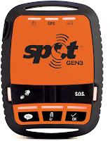 I'll be able to send out a link to my friends and family that will connect them to my device. I won't be able to receive any messages from anyone, but my network will know when I've reached a summit. I can customize two other messages to send anytime during my travels. Now when I don't have cell signal to reach out to anyone, I can at least send some sort of message.
Every message will be attached to GPS coordinate. I have a feeling my Dad will be google mapping a lot from July 2-12. My Mom probably would too, but she's not as tech savy. She'll probably make my niece do it for her.
Departure is 6 days and counting (Click Peaks for Route Description):
July 2: Drive to Rainbow Lakes Trailhead/Camp
July 3: Humboldt Peak/Camp
July 4: Marble Mountain/Camp
July 5: Crestones (Peak & Needle)/Drive to Lake Como TH/Camp
Warning: Route description not meant to be read by parental figures
July 6: Blanca and Ellingwood/Camp
July 7: Drive to West Willow Creek TH/Camp
July 8: San Louis Peak/Drive to Grizzly Gulch/Camp
July 9: Trail Run Sunshine and Redcloud/Lake City Hotel
July 10: Lake City Rest Day
July 11: Open
July 12: Open/Return to Denver
"Expect the Unexpected" ~Unknown. The above schedule fits into my climbing partners Colorado Trail schedule. At the moment the CT is still heavy with snow in some areas, and sighting high waters at creek and river crossings. If she doesn't do the CT, the list above will definitely be changing.
Moderate hypothermia is manageable, but it can turn into severe hypothermia very fast. If you are ever out in the backcountry with some one experiencing hypothermia, get them in dry clothes, and get them insulated as soon as possible. If you have a stove, heat water for bottles, and put the bottles in high pulse areas: the armpits, the torso, the groin.
 MY CLOSETS ARE OVERFLOWING WITH GEAR. This is where things get crazy. The good news about car camping, everything goes. If your hiking into to camp, it gets a little more challenging. What do you absolutely need? What is a nice addition? What is a luxury? After waying your options, hopefully you're down to around 30lbs for a multi-day trip, maybe less.
I'll be climbing Class 3 and above, so the helmet comes along. The late snow could present unexpected surprises, even in July, so the ice axe and crampons come along. The snow probably isn't that bad, so the lighter crampons come along with the lighter boots, instead of the heavy mountaineering boots. Oh, don't forget to rec-oat them with water proofing for the season.
The decisions will go on and on until gear is sorted into the "go stack" and the rest heads back to storage.
THE SPOT. "A day of worry is more exhausting than a week of work." ~John Lubbock. Let's be honest, parents tend to worry, sometimes to the extremes. Just ask me to tell you the Boliver ferry story someday. The reality is, things do happen. So, why worry them anymore than necessary, right? I recently purchased a GPS tracker/signal device called the SPOT Gen3. This will allow me to send up to three customized messages, or in a worst case scenario, send for help.
 I'll be able to send out a link to my friends and family that will connect them to my device. I won't be able to receive any messages from anyone, but my network will know when I've reached a summit. I can customize two other messages to send anytime during my travels. Now when I don't have cell signal to reach out to anyone, I can at least send some sort of message.
"No need to worry. I'm just adventuring around the Rockies"
"The Phoenix has landed. More summits on the horizon."
"What a day. Ready for some sleep."
Every message will be attached to GPS coordinate. I have a feeling my Dad will be google mapping a lot from July 2-12. My Mom probably would too, but she's not as tech savy. She'll probably make my niece do it for her.
Departure is 6 days and counting (Click Peaks for Route Description):
July 2: Drive to Rainbow Lakes Trailhead/Camp
July 3: Humboldt Peak/Camp
July 4: Marble Mountain/Camp
July 5: Crestones (Peak & Needle)/Drive to Lake Como TH/Camp
Warning: Route description not meant to be read by parental figures
July 6: Blanca and Ellingwood/Camp
July 7: Drive to West Willow Creek TH/Camp
July 8: San Louis Peak/Drive to Grizzly Gulch/Camp
July 9: Trail Run Sunshine and Redcloud/Lake City Hotel
July 10: Lake City Rest Day
July 11: Open
July 12: Open/Return to Denver
"Expect the Unexpected" ~Unknown. The above schedule fits into my climbing partners Colorado Trail schedule. At the moment the CT is still heavy with snow in some areas, and sighting high waters at creek and river crossings. If she doesn't do the CT, the list above will definitely be changing.